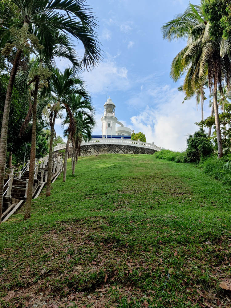
Cape Rachado Lighthouse
Look deep into nature, and then you will
understand everything better.
Keep Going
Cape Rachado Lighthouse (Tanjung Tuan Lighthouse)
Cape Rachado Lighthouse, located on the fringes of Port Dickson, is considered to be the country’s oldest lighthouse. The summit of the lighthouse is accessible through a flight of stairs. The lighthouse is primarily accessible by foot, with the immediate site accessible only via two stairwells: a spiral staircase with 72 steps and a stone stairway behind the lighthouse, the latter acting as a more convenient entry point to the lighthouse. Don’t stop yourself from ascending the flight of stairs. Otherwise, you will miss one of Port Dickson’s top bird-watching places. Because of its convenient position and picturesque surroundings, the lighthouse has become a popular destination for both locals and tourists looking to take in the breathtaking view of the sea. Furthermore, the location is well-known for watching the sunset. Make sure you have your camera ready to capture nature’s wonderful aura.
The lighthouse is perched on a summit at Cape Rachado, some 100 metres inland, and is surrounded by woodland, making it a good place for birdwatching. The current lighthouse was built in 1863 when Malacca was a British-ruled Straits Settlement. What makes it more interesting is that the lighthouse still functions to date.
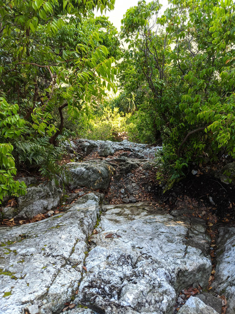
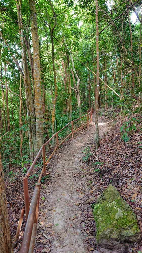
Cape Rachado also provides the perfect hiking spot for those adventurous at heart. The Tanjung Tuan Recreational Forest. There are six trails one can choose from.
1- Forest Trail
Google Maps
This undulating 1-kilometre long trail is the first you’ll come to after you pass through the park gates and begins behind the Tanjung Tuan Recreational Forest ranger station. This track loops through untouched coastal rainforest to exit 50 metres higher, close to the Cape Rachado Lighthouse. There is no beach or picturesque vista, but it is a manageable challenge with intriguing plant life and the prospect of silver leaf monkey and resident raptor views for beginners.
There are some remarkable trees here, including Sepetir and Meranti, as well as a Strangling Fig that holds its dead host tree in a death embrace. Wild ginger plants and macarangga bush have emerged where a fire exposed the forest floor. The trail meets a stairway near the gazebo. If you take the stairs up you will reach the exit. But, if you wish to tackle two trails in a day, then take stairs heading down towards the Dutch Well.
2- Dutch Well Trail
Google Maps
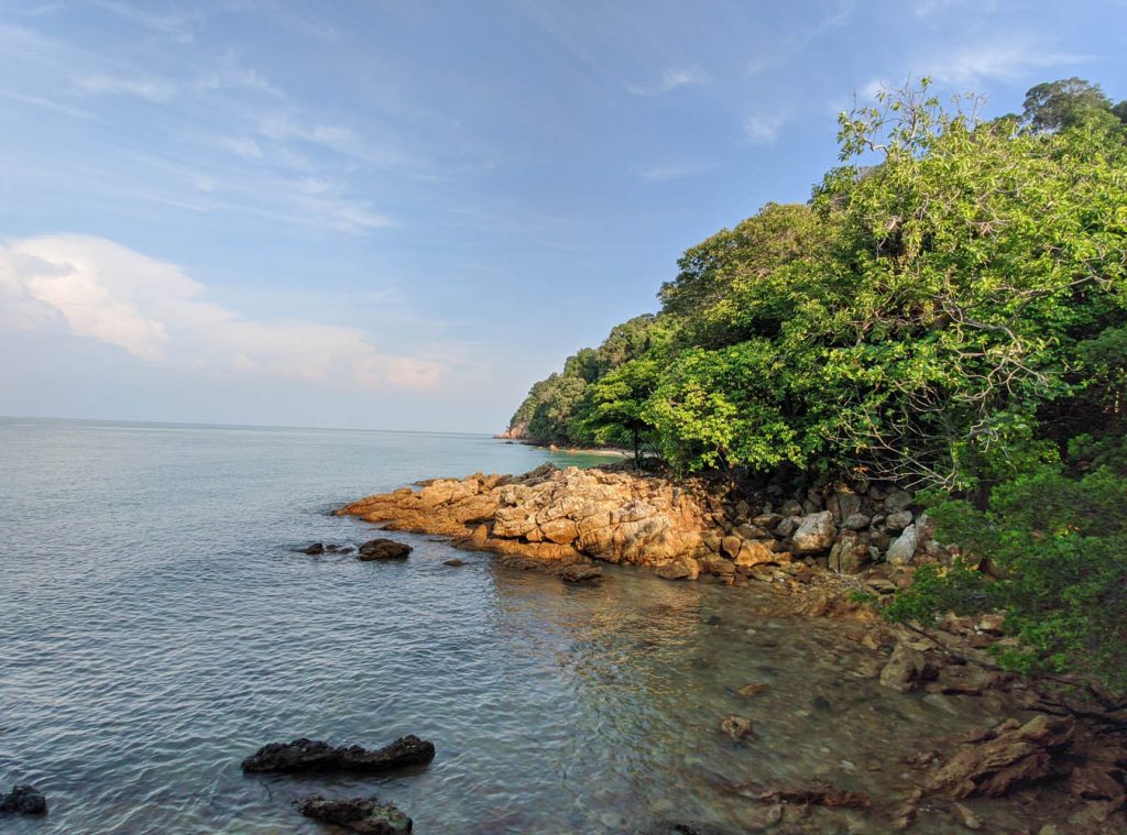
This 650 metres trail starts where the Forest Trail ends, along a concrete path about 100 metres from the lighthouse’s foot. Where the Forest Track turns left behind the gazebo into a thicket of Meranti trees, the Dutch Well trail turns right down a flight of steps that curve down towards a dirt trail and the forest floor. A rickety wooden walkway cuts through the mucky ground beyond the historical well. It’s one of many elements that contribute to the eerie atmosphere that pervades this side of the Tanjung Tuan headland. It’s discreetly disguised behind a curved concrete wall. The walk ends in a section of beach facing Pulau Masjid that is accessible during low tide. Another well, said to have been excavated by Hang Tuah, lies buried to the right, and his “footprint” is said to be embedded on the rocky outcrop adjacent to it.
3- Monkey Bay trail
Google Maps
Because of its short length and picturesque coastal payoff, the Monkey Bay trail is the Malaysian Nature Society’s most requested route during Tanjung Tuan’s annual Raptor Watch event. Its trailhead, which begins below lamppost #20, might deter less daring hikers; a verge of bare soil, worn from use, it’s steep, slippery, and intimidating in appearance, but roped on one side for safety.
4- Vantage Point Trail
Google Maps
The beginning of the Vantage Point path, a short, gently sloping out-and-back track that begins beneath lamppost #19, can appear deceptive. The trail begins as a tangle of thorny Bertam palms and Lemba and Bayas plants, but soon exposes itself to be wide, lush, and sheltered by a canopy of tall Tembusu trees. The trail ends abruptly in a fence after navigating the top of a ridge with the Straits of Melaka to your left. Climb through the bottom hole, and there is a clearing 100 metres on the opposite side to your left, where the trees divide. This vantage point, which offers a stunning view across the crescent-shaped harbour to the craggy limestone outcrop of Bukit Batu Putih, inspired the trail’s name. If you continue straight, you can travel down to Monkey Bay or in the direction of Port Dickson’s iconic Blue Lagoon, as you may have seen on other little trails along the way.
5- Pulau Intan Trail
Google Maps
A trail hidden on the far side of the lighthouse goes down to Pulau Intan, a little rocky peninsula shut off from the mainland when the tide rises. Keep right at the intersection (left leads to the Dutch Well and trail beach) and descend to the beach past the observation points in varying states of decay. You can choose between two beaches. One is rocky and dominated by a solitary Avicennia tree, its lanky roots shooting up from between the earth like gnarled fingers. On the other side of Pulau Intan lies a beautiful sandy beach that is typically uninhabited. Explore Pulau Intan and you’ll come across graves of those who, presumably, chose to make this beautiful site their ultimate resting place.
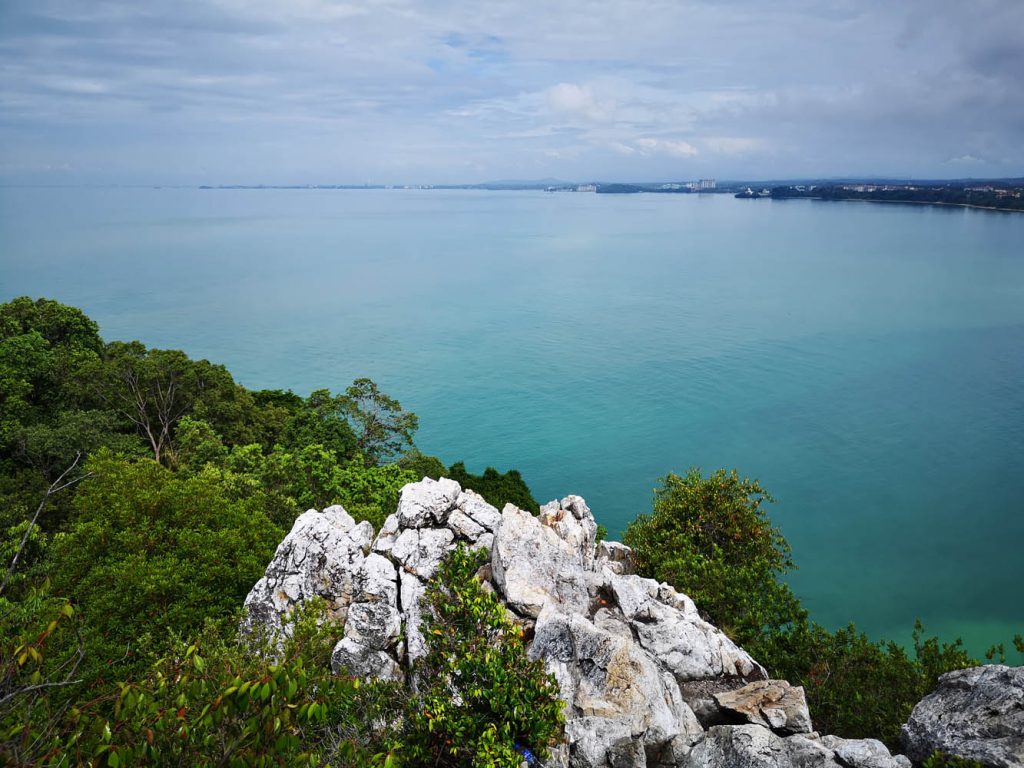
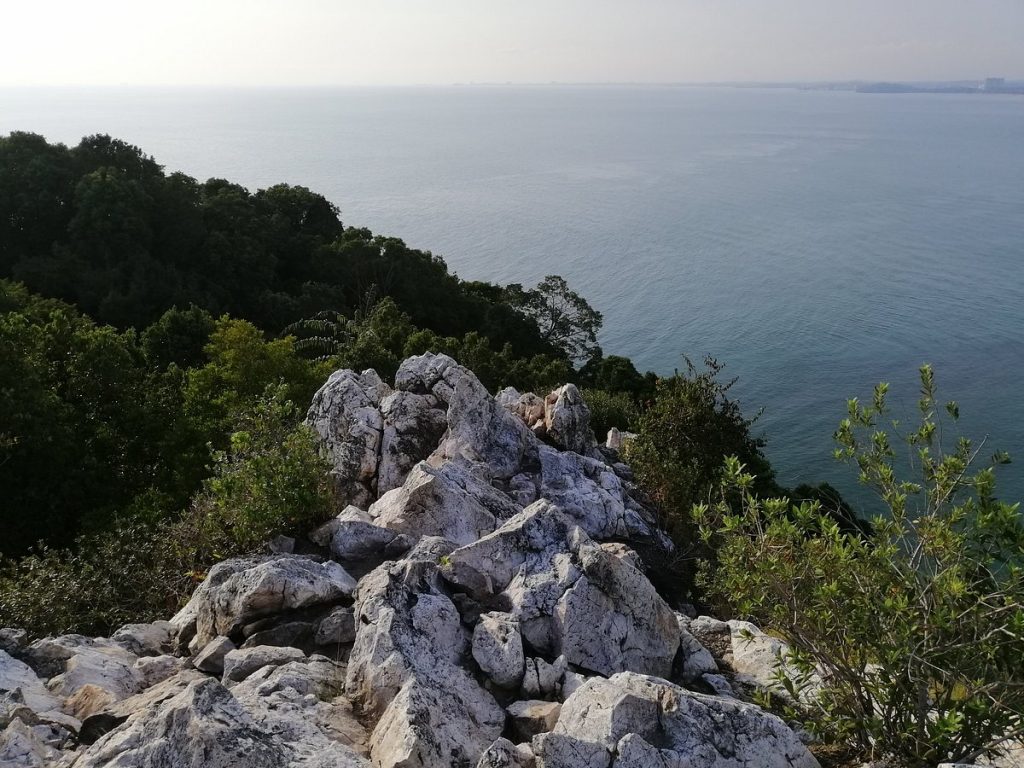
6- Bukit Batu Putih Trail
Google Maps
Tanjung Tuan’s newfound popularity is due to the unexpectedly pleasing views from atop Bukit Batu Putih. The trailhead is located near the foot of Tanjung Tuan’s old lighthouse, at the top of a set of metal stairs against a verge. The track is short and wide, ideal for beginners, and only moderately undulates through the dry coastal terrain. To savour the amazing views, one last push up the peak’s rugged rock face is required. Bukit Batu Putih, with its beautiful blue bays and the Straits of Melaka reaching for miles towards Sumatra, is busiest on weekends, especially just before sunset.